Cairn Cartograph N Selway/Bitterroot Map | Runner's Edge
Coming up: Light the Way 5K
Register >
  • {{product.name}}
    {{product.quantity}} at ${{product.cost}} - {{product.options}}
  • Product Details
    Cairn Cartograph

    N Selway/Bitterroot Map

    18.00 USD SALE

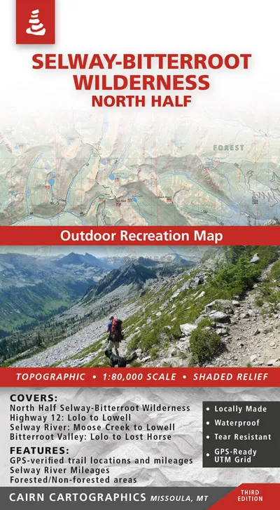
    Covers: -North Half of the Selway-Bitteroot Wilderness -Highway 12: Lolo to Lowell -Montana’s Bitterroot Valley: Lolo to Lost Horse -Selway River: Moose Creek to Lowell -Bitterroot River: Wally Crawford Access to Lolo Features: -Waterproof, tear-resistant plastic -Topographic / shaded relief…

    • OPTIONS: undefined

    • SKU: SEL/BITT-N
    • Description

      Covers: -North Half of the Selway-Bitteroot Wilderness -Highway 12: Lolo to Lowell -Montana’s Bitterroot Valley: Lolo to Lost Horse -Selway River: Moose Creek to Lowell -Bitterroot River: Wally Crawford Access to Lolo Features: -Waterproof, tear-resistant plastic -Topographic / shaded relief -Forested and non-forested areas -GPS verified trail locations and mileages -GPS-Compatible UTM and Lat/Long grids -1:80,000 scale -Contour interval: 100 feet -River mileages on the Bitteroot and Selway Rivers Selway-Bitterroot Wilderness: North Half quantity
    • Sizing

    • Reviews

    • {{altLabel}}
    • {{firstName}} {{reviewDate}}

      {{reviewMessage}}

    • Processing, Please be patient
      Don't Tap Back or Close the Window!
      This could cause the order to duplicate or fail.